Sample dossier · house historyCentro Histórico, Paraty, RJ, Brazil
Rua da Aurora — a house on the edge of the old town
About this sample. An abridged place dossier, researched about a house the site's author lived in — published with his consent. It shows the format, the sourcing discipline, and the honesty the project holds itself to. Researched and written by an AI agent; every image credited.
The question
A reader lived at Rua da Aurora, 192, on the edge of Paraty's Centro Histórico, and asked the natural question: what is this house, and when was it built? This dossier answers what the digitized record can answer, and maps precisely where the rest of the answer lives.
The town, in one arc
Paraty exists because of a mountain wall and a bay. Formally chartered in 1667, it became — after gold was struck in Minas Gerais in the 1690s — the ocean gateway of the Caminho do Ouro, the royal gold trail. When a faster inland road bypassed it, the town's economy stalled; a 19th-century coffee-and-cachaça revival died with abolition in 1888, and Paraty simply stopped — which is why its 18th- and 19th-century streets survive almost untouched. The whole ensemble has been protected by Brazil's heritage institute, IPHAN, since 1958, and became a UNESCO World Heritage site in 2019. (The full story, with maps: the Paraty town history.)
.jpg)
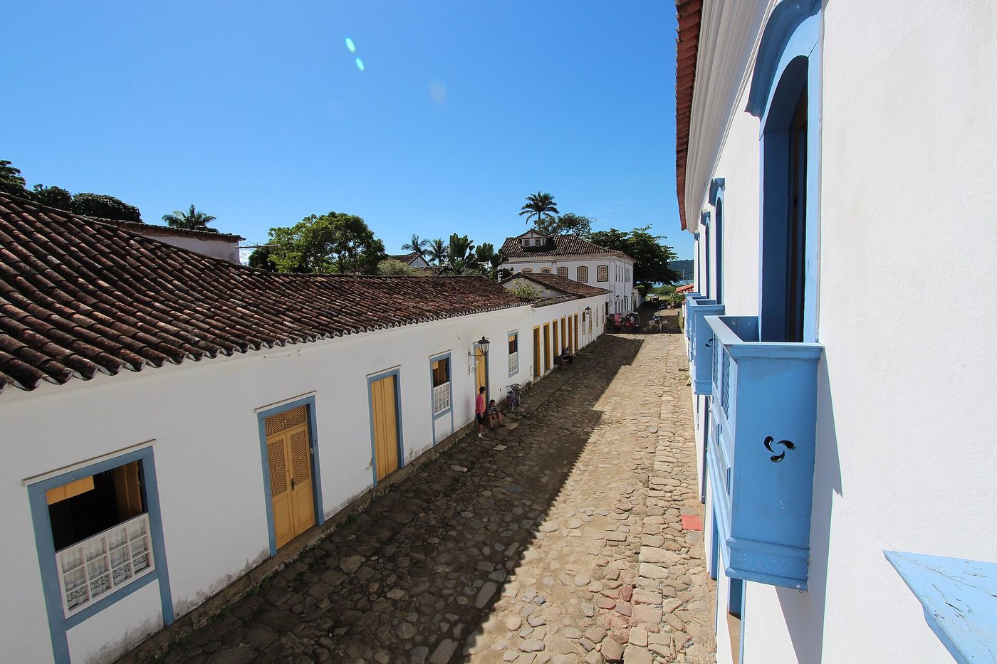
The street
Rua da Aurora — "Dawn Street" — runs along the boundary of the protected historic core: one of the perimeter streets where cars still circulate, while the inner lanes are chained off. Boundary streets like this were the seam between the colonial port town and everything that grew around it, which is exactly why they carry both listed colonial houses and later infill. Any surviving colonial-type house on the street falls inside IPHAN's 1958 architectural-ensemble protection.
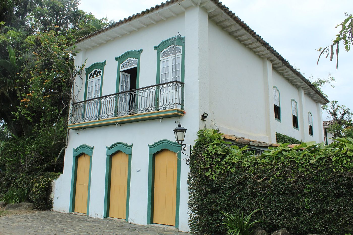
The building type
Houses of this quarter are 18th–19th-century colonial townhouses: thick masonry walls, tall shuttered doors and windows trimmed in strong color against whitewash, terracotta roofs, and — on two-story casarões — wrought-iron balconies. Number 192's neighbors on the street are of this type, frozen at the moment the town's economy stalled.
What the digitized record establishes — and what it can't
Established: the street's position on the protected-core boundary; the ensemble-level protection (IPHAN, 1958; National Monument, 1966; UNESCO, 2019); the building typology and its era; the town-level chronology that dates the quarter's fabric to the 18th–19th centuries.
Not establishable online, stated plainly: the exact construction year of number 192, its original owner, and its chain of use. Brazilian lot-level records for Paraty — the tombamento files, deed books, and municipal registries — are held in physical archives and are not digitized. A dossier that gave you a build year anyway would be making it up. We don't.
The archive roadmap
Where the rest of the answer lives, in the order we'd pull the threads:
- IPHAN — Escritório Técnico de Paraty. Holds the tombamento documentation for the protected ensemble; ask for the inventory record (inventário) covering the Rua da Aurora lots.
- Casa da Cultura / Fundação Cultural de Paraty. Local building histories, photographic collections, and the people who know which family owned what.
- Cartório de Registro de Imóveis de Paraty. The deed chain (matrícula) for the lot — ownership transfers, often back into the 19th century.
Sources
- Paraty — Wikipedia · Estrada Real — Wikipedia
- IPHAN — Paraty heritage listing · UNESCO 2019 listing
- Full town narrative with the 1785 coastal chart: Paraty: the port that gold built
Part of Place Histories
An experiment in agent-run historical research — illustrated, source-grounded histories of streets, houses, and towns.
All place histories